
 English
 Follow us


![[Tancar]](/plantilles/bergueda/img/tancar.png)

01 - Via Verda de Pedret
The old Manresa-Berga railway was planned at the end of the 10th century. XIX, and arrived at the Rosal colony in 1887. At this point a station was built and the works to be continued to Berga were stopped. A different society pushed for the construction of a railway line from Olvan Station to Guardiola de Berguedà, following the river valley: it was a mining railway that finally reached Guardiola de Berguedà in 1904. The 'Olvan a Pedret corresponds to this second stage of construction: 1887-1904. The railway line was closed in 1972 due to the construction of the Baells reservoir. After a year, the section of the station from Olvan to Sallent was also closed leaving the region without rail transport. The railway company started the routes and the crossings and since then, this road has been used to go to Pedret and to this sector of the Llobregat without having to go through Berga.
In recent times, with the increase of family hiking, some arrangements have been made to improve and promote it as a Greenway to the Llobregat. They are about 5 km from an attractive greenway along the river Llobregat ideal for families with cycling or on foot. The route proposal starts at the Pont de Pedret and ends at the parking lot just at the entrance to Cal Rosal, although it can be done in both directions. As the Greenway, there is practically no difference in level and no technical difficulties. Along the way you will find 3 tunnels (the longest is lit) and a bridge to cross the river (in addition to the characteristic Pedret bridge at the beginning).
Description
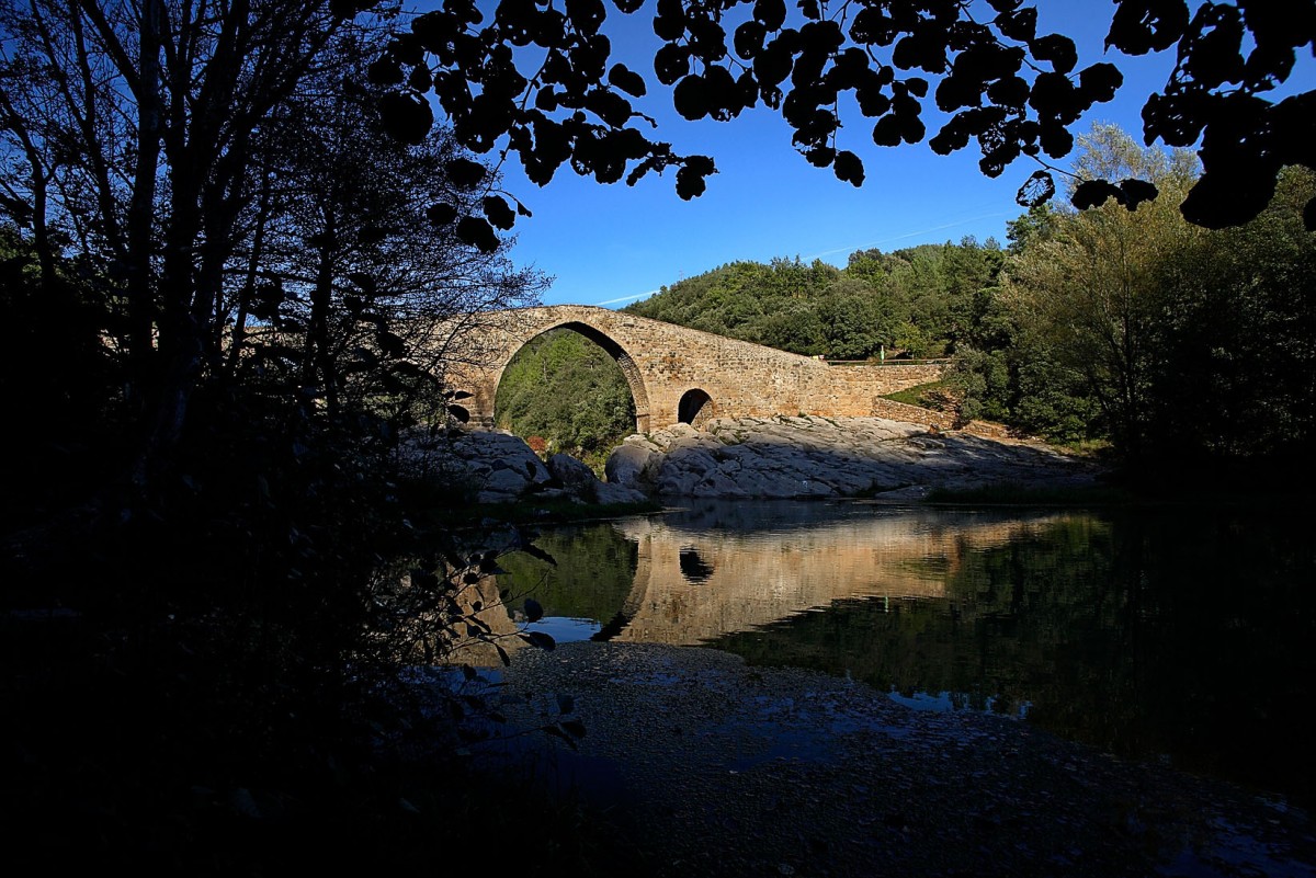
The route starts at Pont de Pedret, a bridge about 80 m long, of medieval origin, on the river Llobregat. Before starting it is advisable to cross the bridge and go up the old path on the left that leads to the church of Sant Quirze de Pedret, and pay a visit. It is one of the best preserved examples of pre-Romanesque religious architecture in Catalonia, built in the Carolingian period (9th-10th centuries).
At the beginning of the route downhill you pass a bridge over the stream that descends from Berga, it is the Pontarró de Fontollera just before the Fisherman's Refuge where there is a spring. You will soon find a rural path on the left that goes down to the river, but the route continues straight and flat. One kilometer down, you will pass the Peirota tunnel of 80 m and then a considerable height bridge that crosses the Llobregat river, it is the Peirota or Vilarrassa bridge, formed by a structure of more than 50 meters long and a approximate width of about 3.75 meters.
Before the next tunnel you will find a fork with the road that goes up to La Portella. Soon, however, you will enter the Vilarrasa II tunnel, which is the longest with a height of 185 m and a radius of 100 m, which you recently decided to put on a lighting system because there was a section without direct light. It is an automatic lighting of solar with leds. Pay attention to how the tunnel works, nothing to do with the current works.
Finally you will pass the 77 m long Vilarrassa I tunnel. Here the valley is widening and soon you will see the lock of the Cal Rosal factory and the buildings of the old Metallic Carbide factory now closed, on the other side of the river. Cross the current C-16 dual carriageway and see some orchards that take advantage of the fertile land and water by the river. You will soon be in Cal Rosal, a textile colony founded in 1858 that was built on an old mill at the foot of the Llobregat river. For many years it was one of the largest and most emblematic industrial colonies in Catalonia. The spinning, weaving and dyeing sections had about 2,000 workers. The Rosal also founded one of the few agricultural colonies in Catalonia, the one in Graugés, in Avià. The colony did not stop growing until well into the twentieth century, but the general textile crisis ended with the closure of its facilities and the demolition of some buildings, such as the old iron station.
Before taking the car you can take a walk around the colony. If you cross the bridge you will be able to access the church and factory, across the road is the artisan commercial and restoration center. If it's mushroom time, you'll find a weekly fair.
Technical sheet
Route number: 01
Town: Olvan
Type: Very easy
Distance: 9.83 km
Time: 1 h.
maximum altitude: 539
height difference: 0 (ruta lineal )
To organise
Cartography: 5-Berga. 1:25.000 Institut Cartogràfic i Geològic de Catalunya Lluçanès 1:30.000. Ed. Alpina
More information
Bibliography: Inventari de Patrimoni: patrimonicultural.diba.cat Civitas Cultura: www.civitascultura.org
Documents and links
OFICINA DE TURISME DEL BERGUEDÀ
Customer service opening hours:
from Monday to Friday from 9 am to 2 pm.
on public holidays falling from Monday to Friday from 10 am to 2 pm.
Tel. +34 654 125 696
E-mail: turisme@elbergueda.cat
![]()
ACKNOWLEDGMENTS

[Premsa]
Other


Follow us


