
 English
 Follow us


![[Tancar]](/plantilles/bergueda/img/tancar.png)
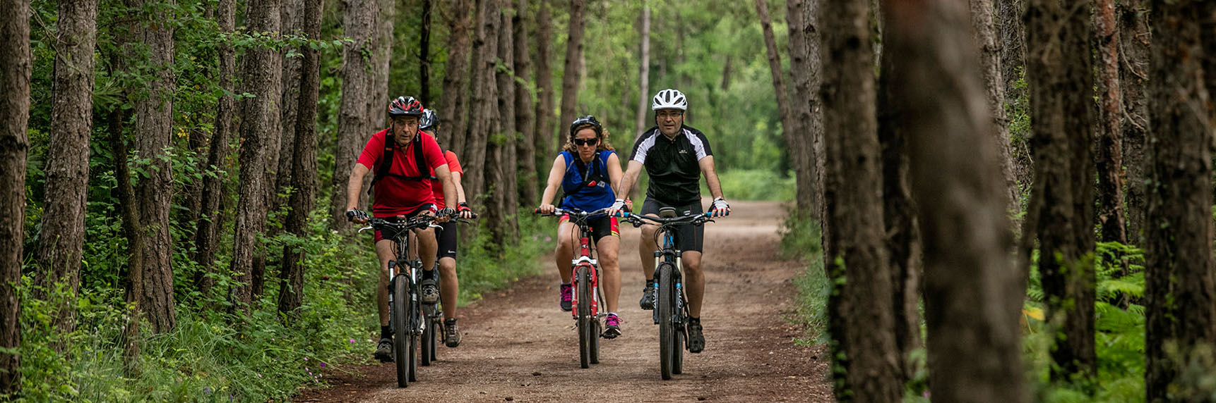
La gran circular d'Ensija en BTT
Thinking about a tour that links the findings of dinosaur remains and the mining world is thinking about a route that from Sant Corneli, an old mining colony belonging to Cercs, passes through Fumanya (where in addition to the mines of Coll de Fumanya and Pla de la Barraca there are also numerous dinosaur footprints) Vallcebre (where you can find in the vicinity, several testimonies of both its mining past and dinosaur remains) and Peguera, a town now abandoned but with an important mining past. But being a mountain bike route, one of the main attractions of the area cannot be left out. The forests and landscapes of the Serra d'Ensija, on the one hand, with wonderful views of Pedraforca. And on the other hand, the Cinglera and Pla de Vallcebre, with the landscapes of the southern slope of Berguedà. This route of 46.46 km and 1,623 meters of total accumulated elevation gain undoubtedly requires a good physical level, but the satisfaction of the route more than compensates for it. A route to fully enjoy Alt Berguedà.
Description
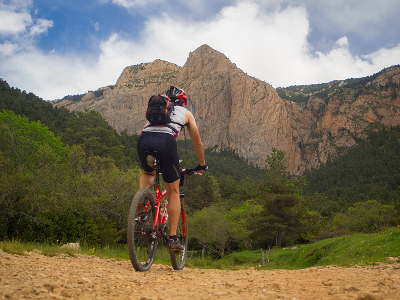
The route begins at the Cercs Mines Museum (located in Sant Corneli), at 960 meters above sea level, climbing to the top of the town to show the characteristic mining style. As soon as you get on the road, you connect with the track that leads to El Jou, a huge hostel and activity school surrounded by a lot of horses, and then continue along the path that goes up to Coll de Bous. There begins one of the most demanding climbs of the route (El Grau de les Granotes) that allows you to cross the imposing cliff of Vallcebre. At the top, the views are spectacular. But you have to continue north, making a short 2.7 km detour to the Sant Ramón hermitage to enjoy impressive views of Pedraforca with the Serra del Cadí in the background. The descent to Vallcebre, where there are several services, is fast and quite direct. The first almost 10 km. will surely have impressed the participant.
The second part of the route begins in Vallcebre: the climb to almost Coll de Pradell, going around the Serra d’Ensija. It is a wonderful climb, of almost 10 km, through the forests, meadows and pastures of the northern slope of the Serra d’Ensija and under the “constant vision” of Pedraforca in a beautiful natural environment. Pure mountain biking until the asphalted track –almost to Coll de Pradell- along which you have to descend towards the Palomera area for just over 500 meters to find the path on the left that climbs again along Coll Ginebrer and that will finish going around the Serra d’Ensija towards Coll de Portet.
It is worth saying that Coll de Portet is a beautiful place: a small meadow, next to a cattle pen, to enjoy, on one side, a magnificent view of Pedraforca with Cadí in the background. On the other side, the imposing Rasos de Peguera. On one side, the spectacular cliff of the Ferrús rocks, below the Gallina Pelada, where the GR107 Bons Homes i Bones Dones trail runs. But this meadow is also a loser if you don't have a very clear itinerary. Following the track in detail, you connect with a small path that goes down very straight (at some very specific points you even have to walk) through the forest to the Molar pass and, then, Cal Sec, where it connects with the GR107-1 (the bicycle variant of the BH and BD) that goes from Peguera to Bonner. Here there is again a good track - increasingly better - to Peguera.
Peguera's mining past cannot be forgotten. Today abandoned, this small town located at the foot of a small hill experienced its splendor during the first half of the 20th century. At the Font de Cal Coix (another magnificent washhouse) you have to leave the GR that goes down to the Queralt Sanctuary to go up to the Coll de la Creu de Fumanya. The road is right there, but it is much better to take the route along the bottom of the valley, even at times on the other side.
Because following old roads, paths and trails, the route runs between shady beech forests, small boxwoods surrounded by extensive meadows, magnificent black pine forests or, at the end, ancient holm oaks. An amalgam of landscapes in a long descent of more than 5 km (until you find the road again) with an enormous diversity of environments that will make mountain bike enthusiasts enjoy it to the fullest. You only need to go down the road about 50 meters to turn right again and continue along a track that takes a long walk (as far as Fígols) over a mine that has now been closed. This is revealed by the remains of old abandoned structures and the surrounding landscapes.
Fígols, a small and quiet village of a dozen houses around the church, undoubtedly has a very special charm. A hundred meters further on, in order to avoid the asphalt road, the route turns right, following the signs for the Font de la Perera until you find the main road. On the right is the aforementioned fountain (about 300 meters away, with a nice washhouse). On the left, the final destination: Sant Corneli. You enter through the lower part of the village, next to the Cers Mining Museum.
Technical sheet
Route number: B03
Town: Cercs
Type: Difficult
Starting point: Museu de les Mines de Cercs
Ending point: Museu de les Mines de Cercs
Distance: 46,5 Km
Time: 5,5 hores
maximum altitude: 1829 metres
height difference: 1600 metres
To organise
Cartography: 5-Berga. 1:25.000 Institut Cartogràfic i Geològic de Catalunya. 45-Parc Natural del Cadí-Moixeró W. 1:25.000. Institut Cartogràfic i Geològic de Catalunya
More information
Bibliography: Peguera, l’ànima d’un Poble. Ramón Soler. Ed. Pages Editors. ISBN. 978-84-9975-064-4
Documents and links
OFICINA DE TURISME DEL BERGUEDÀ
Carretera C16 Km 96
08600-Berga. Phone (+34) 654 125 696
Monday to Friday: 9 to 14h.
Saturday: 10 to 14 & 16 to 18h.
Sunday and holidays: 10 to 14h.
E-mail: turisme@elbergueda.cat
![]()
ACKNOWLEDGMENTS

[Premsa]
Other


Follow us


